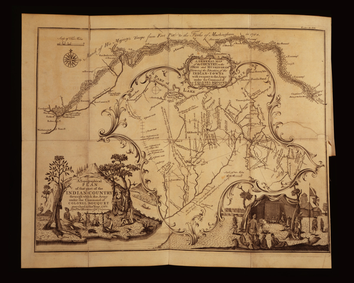
A General Map Of The Country On The Ohio And Muskingham Showing The Situation Of The Indian-Towns With Respect To The Army Under The Command Of Colonel Bouquet March Of His Majesty's Troops From Fort Pitt To The Forts Of Muskingham In 1764 /
About this image...
Image Title: A General Map Of The Country On The Ohio And Muskingham Showing The Situation Of The Indian-Towns With Respect To The Army Under The Command Of Colonel Bouquet March Of His Majesty's Troops From Fort Pitt To The Forts Of Muskingham In 1764 /
Creator: Hutchins, Thomas, 1730-1789, engraver
Date: 1765
Summary: Map showing Native towns in the Ohio River Valley.
Notes: Illus. in: An historical account of the expedition against the Ohio Indians, in the year 1764 [...] / published from authentic documents by a lover of his country. Philadelphia : Printed and sold by W. Bradford, 1765.|Published in: Many nations: A resource guide for the study of Indian and Alaska native peoples of the United States / edited by Patrick Frazier and the Publishing Office. Washington : , 1996, p. 61.
Subjects: Bouquet's Expedition, 1763
Indians of North America--1760-1770
Ottawa Indians--1760-1770
Original Media: Engraving
Collections:
About our unframed prints...
Our prints consist of heavy-stock, semi-gloss paper for the best possible combination of color vibrancy and durability. The brilliant colors we achieve are due in large part to the unique inks we use.